

How Flood Modelling Supports Effective Flood Risk and Water Management
Flooding rarely results from a single process. Rainfall, river flows, drainage systems, ground conditions and the built environment can combine in different ways, creating complex challenges for flood and water management across entire catchments.
Effective flood and water management requires more than identifying which locations may flood. Organisations also need to understand where water comes from, how it moves through rivers, floodplains and urban areas, and what the consequences could be for communities, infrastructure and the environment.
Flood modelling provides this wider perspective. Whether used to investigate river behaviour, assess surface water flooding, produce flood hazard maps, support infrastructure development, or forecasting, it turns complex processes into evidence for practical decisions.
Understanding Flood Risk Through Catchment Modelling
Every catchment responds differently to rainfall. Its behaviour is influenced by topography, soil conditions, land use, river networks, drainage infrastructure and ongoing development.
Heavy rainfall in upstream areas can increase river flows downstream, while saturated ground can generate higher levels of surface water runoff. In urban environments, elevated river levels may restrict drainage systems from discharging effectively, increasing the likelihood of flooding.
Understanding these interactions is essential for effective catchment management. By simulating how water moves through interconnected systems, flood modelling and hydraulic modelling help organisations identify vulnerable locations, understand the drivers of flood risk and assess potential flood risk management measures.
This catchment-wide perspective enables decision-makers to move beyond isolated problems and understand how changes in one area may influence flood risk elsewhere.
River and Floodplain Modelling: Following Water Beyond the Channel
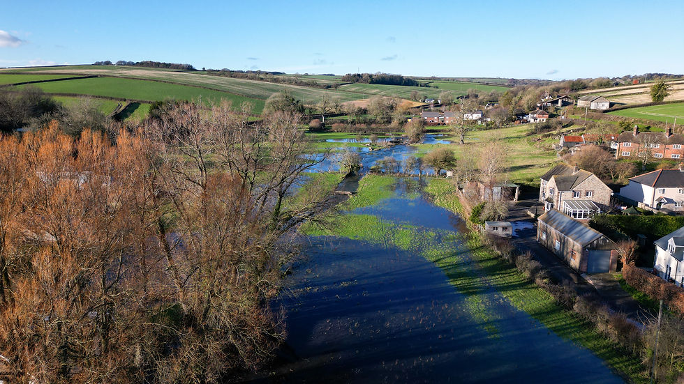
During high flows, water may exceed the capacity of a river channel and spread across the surrounding floodplain. Its route can be influenced by bridges, culverts, weirs and embankments.
River and floodplain modelling can show where water may travel, how deep it could become and how quickly it may move. A one-dimensional model may represent river channels and structures in detail, while a two-dimensional model shows how water spreads across the landscape. Linking 1D and 2D modelling approaches provides a fuller view of flood behaviour.
The results can highlight restrictions in channel capacity, identify where water may leave the river and show which structures influence water levels. They can also reveal whether changes in one area could affect flood risk elsewhere.
Once flood behaviour is understood, modelling can also be used to assess potential management measures, including flood walls, storage areas, channel improvements and natural flood management.
Proposed interventions can be compared with existing conditions to determine whether they reduce flood depth, extent or hazard. Modelling can also identify whether a measure could transfer risk elsewhere, helping organisations compare options and refine designs before implementation.
Urban Flood Modelling and Surface Water Flood Risk
Flooding in towns and cities can be particularly complex. Intense rainfall may overwhelm the ground, drainage infrastructure or nearby watercourses, while buildings, roads, walls and kerbs shape surface water flow routes.
Hydraulic modelling can identify where water may collect, how it moves through developed areas and which properties or infrastructure could be affected. Surface water models can also be connected to rivers and drainage networks to represent interactions between different flood sources.
For example:
High river levels may prevent drainage systems from discharging effectively.
Overloaded drainage networks may increase surface water flooding.
Surface water runoff may contribute additional flows to nearby watercourses.
Understanding these interactions can support drainage improvement projects, maintenance programmes and targeted flood risk management strategies.
Potential interventions can also be tested across several flood events. This helps organisations understand how drainage upgrades, storage areas or other measures may perform under different conditions, including when their design capacity is exceeded.
Flood Hazard Mapping: Looking Beyond Flood Extent
Knowing where flooding may occur is only one part of understanding flood risk.
Flood extent maps show the areas that could be affected, but they do not fully explain the severity of flooding or the danger it may pose to people, property and infrastructure.
Flood hazard mapping combines key outputs from hydraulic models, including:
Flood depth
Flow velocity
Duration of flooding
Rate of onset
Hazard classifications
These outputs provide a more complete picture of flood risk and help organisations identify locations where the consequences of flooding may be most severe.
Maps can highlight areas of high hazard, while animations and visualisations show how a flood event develops over time and how quickly floodwater reaches vulnerable locations.
These visual outputs make complex technical findings easier to interpret, supporting communication with planners, emergency responders, infrastructure operators and local communities. They also help prioritise investments in flood risk management measures by identifying where interventions could deliver the greatest benefit.
Flood Forecasting and Emergency Response Planning
Flood modelling is not limited to long-term planning. It also plays a valuable role during live flood events.
Flood forecasting systems combine predicted rainfall, observed river levels and hydraulic models to estimate how conditions may develop in the hours or days ahead. This provides operational teams with critical information before flooding occurs.
Forecasting outputs can support decisions such as:
Issuing flood warnings
Deploying temporary flood defences
Closing roads and transport routes
Protecting critical infrastructure
Moving people, equipment or resources away from areas at risk
Although uncertainty remains an inherent part of forecasting, access to reliable flood forecasting information allows organisations and emergency responders to prepare earlier and coordinate more effectively.
By providing additional lead time, flood forecasting helps reduce disruption and improve resilience during extreme weather events.
From Understanding Flood Risk to Managing It Effectively
As climate pressures, urban development and ageing infrastructure increase the complexity of flood risk, organisations need reliable tools to support effective decision-making. Effective flood and water management depends on understanding the connections between rainfall, rivers, drainage networks, floodplains and urban areas.
Flood Modeller helps consultants, risk management authorities and infrastructure organisations represent these systems through integrated hydrological, 1D and 2D hydraulic modelling. Users can investigate flood behaviour, assess management scenarios and create visual outputs that support communication and decision-making.
From river and floodplain studies to urban flood analysis, hazard mapping and forecasting, Flood Modeller helps organisations move from understanding flood risk to managing it more effectively.
Start your free trial today to discover how Flood Modeller can help you understand and manage flood risk with greater confidence.


